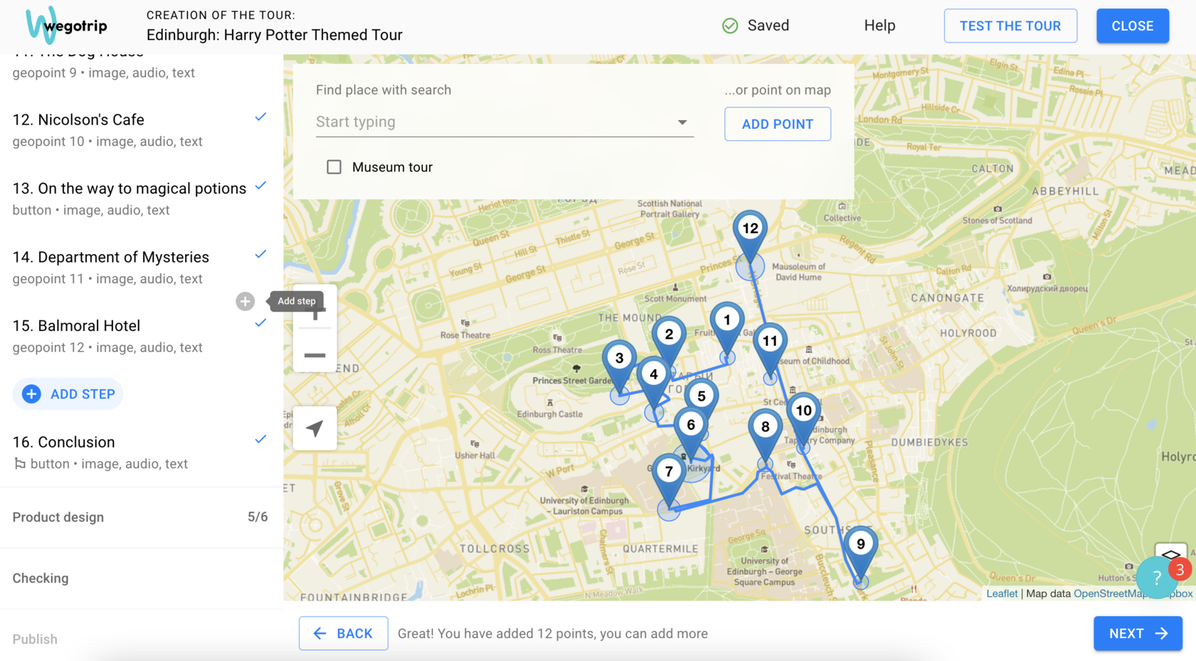
Route Creation and Tour Structure
Adding stops on the map
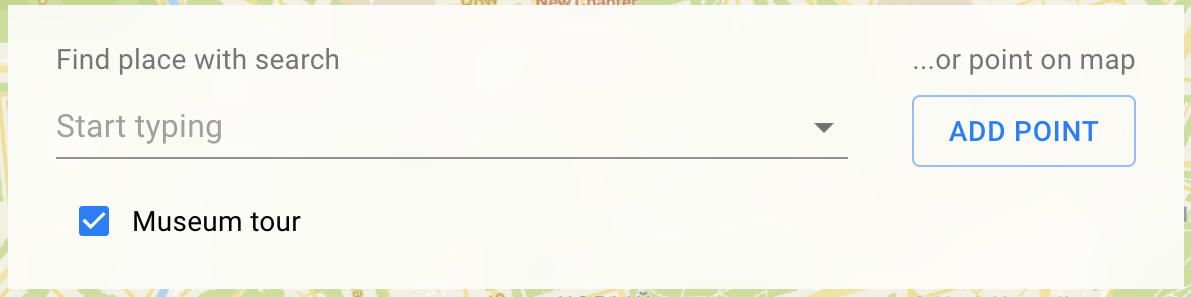
Add geotags indicating all stops on the tour.
- Add all stops by entering the address, name of the place, or coordinates in the search box. You can also place the geotag manually.
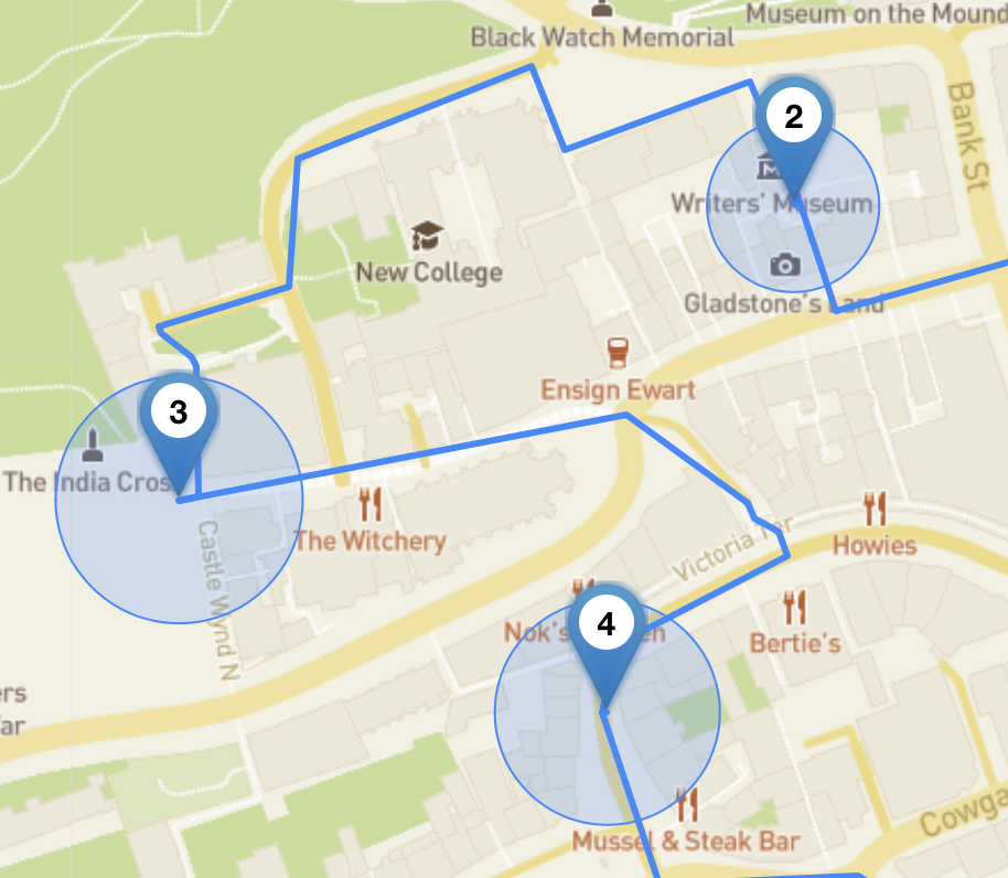
- Edit the location of the geotags by dragging them to the correct position on the map.
- Edit the radius of the geotags.
Radius is the trigger zone of geotags. When tourists step inside the radius area, the app will automatically play the next step of the tour.
The minimum number of geotags:
If you’re creating a museum tour, indicate it in the route creation section.
- In a walking tour – 10;
- In a museum tour – 1. It indicates the starting point of the tour.
If you’re creating a museum tour, indicate it in the route creation section.
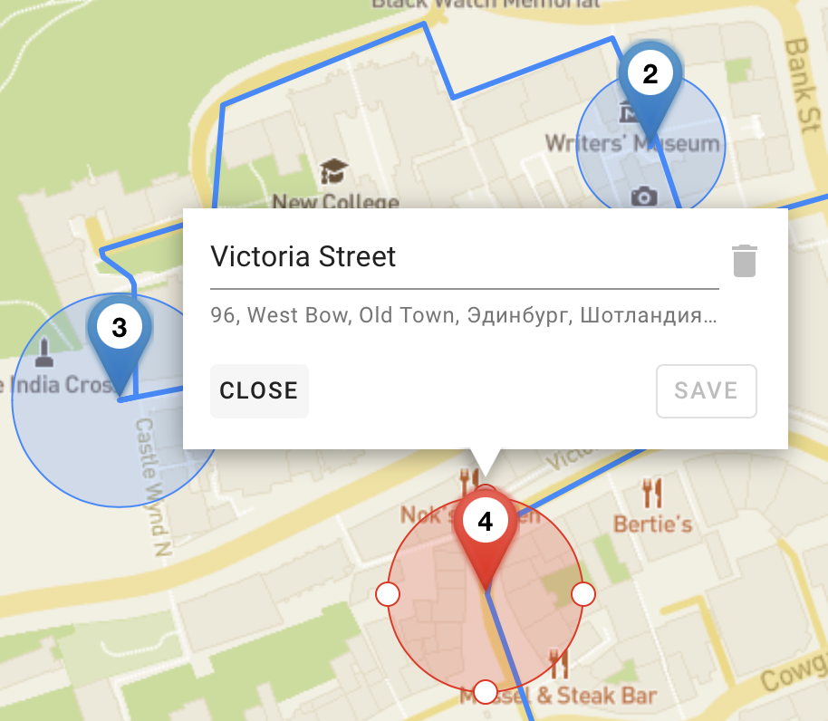
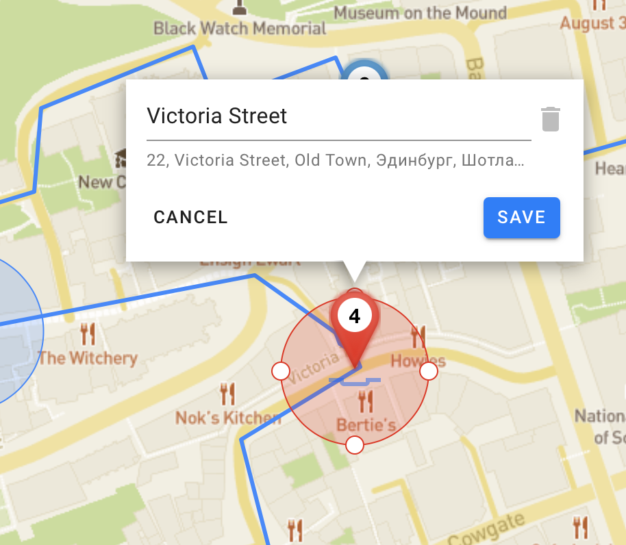
How to edit the location of the geotags
To edit a geotag:
- Select a geotag by clicking on it – the geotag will turn red
- Move it to the right place
- Save Changes
Steps not connected to geolocation on the map
If you need to create steps that are not connected to certain geotags, you can do it in the list of steps in the left part of the tour designer.
It is needed in cases when stops are located too close to each other or the narration at one location should be divided into several steps. In museum tours, the steps inside a museum are not connected to locations on the map either.
Every step can be connected to and disconnected from a certain location on the map while editing the step’s content.
Every step can be connected to and disconnected from a certain location on the map while editing the step’s content.
The sequence of steps on a tour
The sequence of steps can be changed by dragging the steps to the desired place in the list on the left.